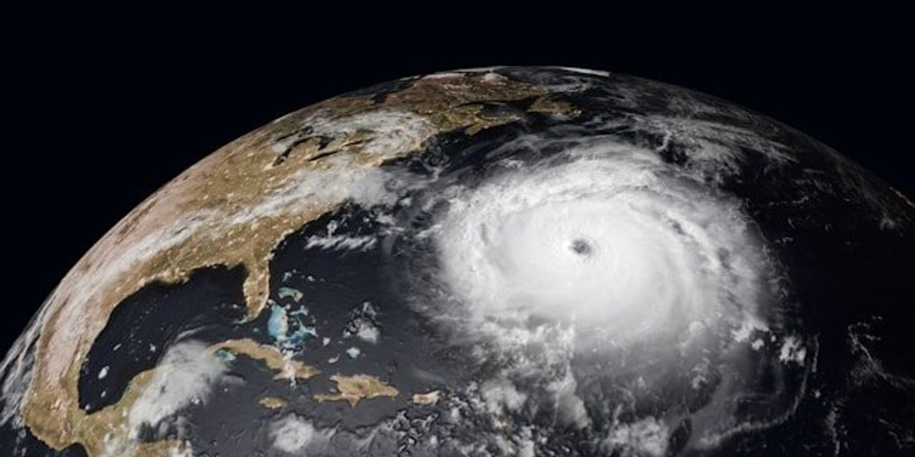
Hurricane Erin shows how global warming supercharges storms over warm oceans
Hurricane Erin intensified from a Category 1 to a Category 5 storm in less than 24 hours, a rapid escalation scientists link directly to rising ocean temperatures driven by climate change.
Sachi Kitajima Mulkey reports for The New York Times.
In short:
- Hurricane Erin's wind speed increased by nearly 85 mph in 24 hours, qualifying as one of the fastest intensifying storms ever recorded.
- Scientists say human-caused climate change has made warm ocean conditions, key to storm strength, 90% more likely in Erin’s region, leading to stronger winds, more rain, and greater coastal damage.
- Warmer seas, rising tides, and added atmospheric moisture contribute to larger storm surges and flooding, even when hurricane winds stay offshore.
Key quote:
“All of these behaviors are ultimately linked to the warm water that these storms are sitting on top of. The water is warm because the planet is heating up.”
— Jim Kossin, former hurricane specialist and climate scienetist at the National Oceanic and Atmospheric Administration
Why this matters:
As global temperatures rise, hurricanes are intensifying faster and becoming wetter, larger, and more damaging. The oceans absorb most of the excess heat from greenhouse gas emissions, and that warmth fuels stronger storms. This makes coastal communities — many already vulnerable — more likely to experience flooding, erosion, and power outages even from storms that don’t make landfall. Warmer air holds more moisture, increasing rainfall rates and prolonging post-storm flooding. Higher sea levels raise the baseline for storm surge, meaning the same storm now causes more damage than it would have decades ago. These climate-driven shifts are already changing how hurricanes behave, when they form, and how much destruction they leave behind.
Related: Climate-fueled disasters threaten the survival of local small businesses